Type search term & press return
New
Furniture
Fine Art
Ceramics
Clocks
Jewelry
Fashion
More
Events
Creators
Destinations
About
For Dealers
Contact
Facebook
Twitter
Instagram
Nederlands
English
Home
Fine Art
Fine Art
Fine Art
Paintings
More Fine Art
Sculptures
Drawings and Watercolor Paintings
Photography
Graph
Mixed Media
Prints and Multiples
Search
Clear
Price
Clear
Period
Clear
16th century and before
17th century
18th century
19th century
20th century
21st century
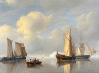
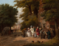
P173 P.J. Schotel
€ 4950
Van Brug Collection
Jan Jan Jacob Zuidema Broos
JAN JACOB ZUIDEMA BROOS (1833-1882) – THE FORTUNE TELLER
Price on request
Daatselaar Fine Art & Antiques
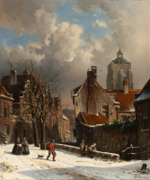
Adrianus Eversen
ADRIANUS EVERSEN (1818-1897) – A SNOWY DUTCH STREET SCENE
Price on request
Daatselaar Fine Art & Antiques
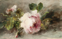
MARGARETHA ROOSENBOOM (1843-1896) – FLOWER STILL LIFE WITH P...
Price on request
Daatselaar Fine Art & Antiques
Andreas Schelfhout
ANDREAS SCHELFHOUT (1787-1870) – DUNE LANDSCAPE IN SUMMERTIM...
Price on request
Daatselaar Fine Art & Antiques
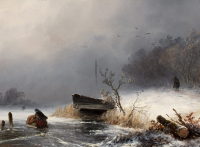
Johannes Franciscus Hoppenbrouwers
J. F. HOPPENBROUWERS (1819-1866) – WINTERLANDSCAPE
Price on request
Daatselaar Fine Art & Antiques
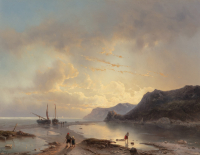
Louis Johan Hendrik Meijer
LOUIS JOHAN HENDRIK MEIJER (1809-1866) – EVENING TWILIGHT BY...
Price on request
Daatselaar Fine Art & Antiques
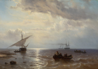
Louis Johan Hendrik Meijer
LOUIS JOHAN HENDRIK MEIJER (1809-1866) – SHIPS OFF THE COAST...
Price on request
Daatselaar Fine Art & Antiques
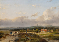
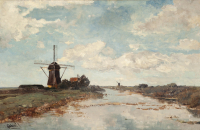
Paul Joseph Constantin (Constant) Gabriël
PAUL JOSEPH CONSTANTIN GABRIËL (1828 – 1903)- VIEW ON THE PR...
Price on request
Daatselaar Fine Art & Antiques
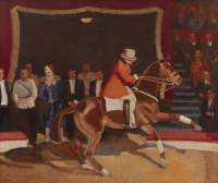
Kees Maks
KEES MAKS (1876-1967) – CIRCUS DIRECTOR JEAN HOUCKE IN THEAT...
Price on request
Daatselaar Fine Art & Antiques
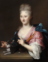
Arnold Boonen
ARNOLD BOONEN (DORDRECHT 1669-1729 AMSTERDAM) – A PORTRAIT O...
Price on request
Daatselaar Fine Art & Antiques
Jean-Pierre Cassigneul
JEAN-PIERRE CASSIGNEUL (1935-) – LE COUPE DE GLACE
Price on request
Daatselaar Fine Art & Antiques
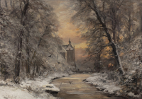
Louis Apol
LOUIS APOL (1850-1936) – WINTER FOREST SCENE WITH DE CANNENB...
Price on request
Daatselaar Fine Art & Antiques
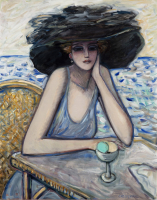
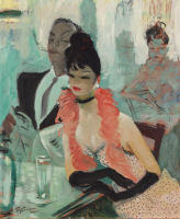
Jean-Gabriel Domergue
JEAN GABRIEL DOMERGUE (1889-1962) – COUPLE AT THE TABLE
Price on request
Daatselaar Fine Art & Antiques
Jean-Pierre Cassigneul
JEAN-PIERRE CASSIGNEUL (1935-) – LA ROBE NOIR
Price on request
Daatselaar Fine Art & Antiques
Kees Verkade
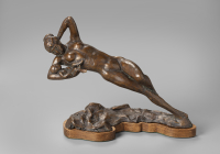
A gift for life
Price on request
Daatselaar Fine Art & Antiques
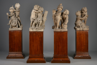
Jan Claudius de Cock, Four sandstone statues, an Allegory of...
Price on request
Kollenburg Antiquairs BV
Pair of terracotta Louis XVI plaquettes, attributed to Gill...
Price on request
Kollenburg Antiquairs BV
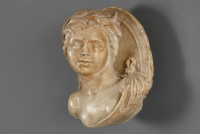
Italian marble Renaissance shield portrait
Price on request
Kollenburg Antiquairs BV
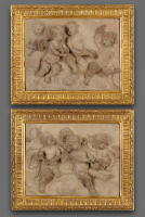
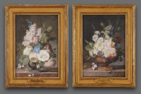
Jean Louis Prévost (1745-1827), pair of gouaches
Price on request
Kollenburg Antiquairs BV
Jean-Pierre Cassigneul
Jean-Pierre Cassigneul 'La Régate'
Price on request
La Doyenne Vintage
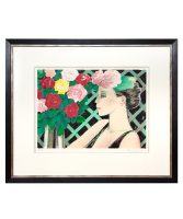
Jean-Pierre Cassigneul
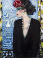
Jean-Pierre Cassigneul 'Profil aux roses'
Price on request
La Doyenne Vintage
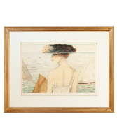
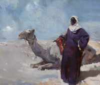
Piet van der Hem
Touareg with a Dromadery
Price on request
Daatselaar Fine Art & Antiques
Willem Heesen W.
W. Heesen, Oude Horn Piet v. Klei, unique glass artwork, 810...
Price on request
Kunstconsult
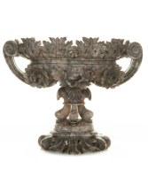
A Grey Alabaster Oval Coupe
Price on request
Van Nie Antiquairs
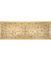
An Imperial Yellow-ground Embroidered Silk Panel
Price on request
Van Nie Antiquairs
Dutch Barometer
€ 12500
Toebosch Antiques
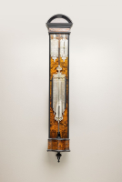
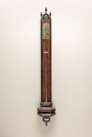
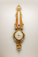
Rosewood Banjo Barometer with Thermometer
€ 12850
Toebosch Antiques
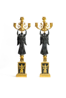
Set of two french empire candelabra
€ 16500
Toebosch Antiques
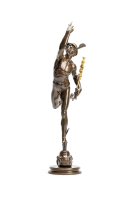
Bronze Hermès
€ 6850
Toebosch Antiques
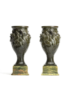
Art Nouveau bronze patinated vases
€ 8500
Toebosch Antiques
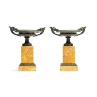
A pair of siena marble tazza's
€ 2450
Toebosch Antiques
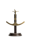
scale
€ 1250
Toebosch Antiques
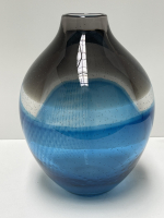
Frank van den Ham
Frank van der Ham, 950301, vase shape, fused, deformed and p...
€ 1250
Kunstconsult
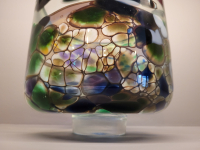
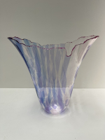
Floris Meydam
Floris Meydam, one-off made in Frome England, clear, blue an...
€ 950
Kunstconsult
C. Relet A ROUEN circa 1700
€ 9850
Toebosch Antiques
← Previous
1
(current)
2
3
4
5
6
7
…
28
Next →
Follow ArtListings
Site by
Artimin
Follow ArtListings